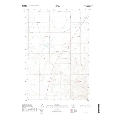
2020 Map of Plunket Lake
USGS Topo · Published 2020About this map
Mammoth Springs and Plunket Lake anchor this Broadwater County landscape, where the Missouri River valley's hydrological infrastructure meets the rising terrain of the Elkhorn foothills. The importance of water management in this arid stretch of Montana is visible through the Toston Canal, which winds along the eastern edge of the quadrangle. Local landmarks like the uniquely named Chewh-toowh-too-peh Hill provide distinctive topographic orientation for the region. The map details a network of named rural routes, including Lone Mountain Rd, Spikes Ln, and Buffalo Jump Rd, which trace the legacy of ranching and early land divisions. Natural drainage patterns are defined by Salt Gulch, Spring Cr, and the southward flow of Warm Springs Cr, illustrating the complex interplay between the valley floor and the surrounding mountain slopes.
Find a feature on this map
23 named features on this map. Tap any name to fly to it.
Don’t see what you’re looking for? This feature index may not catch every label — zoom into the map to look around manually.
Map Details
Editions of this 2020 Plunket Lake Map
This is the sole edition of this map. No revisions or reprints were ever made.
Other maps of this area

1886 · Fort Logan
USGS Topo · 1:250,000

1888 · Three Forks
USGS Topo · 1:250,000

1894 · Three Forks
USGS Topo · 1:250,000

1895 · Three Forks
USGS Topo · 1:250,000

1947 · Bozeman
USGS Topo · 1:250,000

1948 · Bozeman
USGS Topo · 1:250,000

1948 · White Sulphur Springs
USGS Topo · 1:250,000

1949 · Radersburg
USGS Topo · 1:62,500

1949 · Manhattan
USGS Topo · 1:62,500

1949 · Toston
USGS Topo · 1:62,500