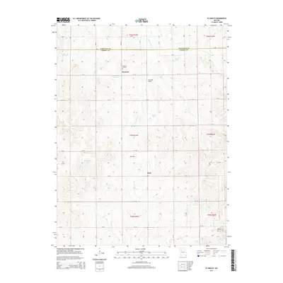
2015 Map of Plymouth
USGS Topo · Published 2015About this map
Plymouth and the small settlement of Quote anchor this 2015 study of the north-central Missouri plains, where the boundary between Livingston Co and Carroll Co splits the landscape. The region is defined by a dense network of county roads and several prominent water bodies, including Wallace Lake Section 6 and Wallace Lake Section 9. The terrain features distinct geographic landmarks such as Low Gap Valley and a separate area simply labeled Low Gap, which dictate the local drainage patterns of Cottonwood Cr and Turkey Cr.
Find a feature on this map
53 named features on this map. Tap any name to fly to it.
Don’t see what you’re looking for? This feature index may not catch every label — zoom into the map to look around manually.
Map Details
Editions of this 2015 Plymouth Map
This is the sole edition of this map. No revisions or reprints were ever made.
Other maps of this area

1889 · Lexington
USGS Topo · 1:125,000

1924 · Dawn
USGS Topo · 1:62,500

1924 · Braymer
USGS Topo · 1:62,500

1950 · Coloma
USGS Topo · 1:24,000

1950 · Plymouth
USGS Topo · 1:24,000

1951 · Utica
USGS Topo · 1:62,500

1953 · Moberly
USGS Topo · 1:250,000

1954 · Moberly
USGS Topo · 1:250,000

1957 · Moberly
USGS Topo · 1:250,000
1957 · Roads
USGS Topo · 1:24,000