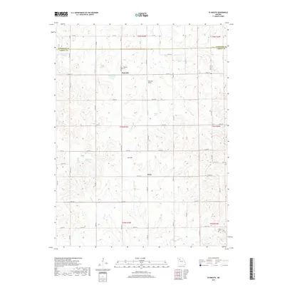
2017 Map of Plymouth
USGS Topo · Published 2017About this map
Plymouth and the surrounding rural landscapes of Carroll County and Livingston County are defined by a network of small upland lakes and drainage creeks. This survey reveals a pattern of dispersed settlement connected by a grid of county roads and state highways like State Hwy N and State Hwy D. The topography is characterized by prominent landmarks such as Low Gap Valley and the smaller Low Gap to the south, which influence the winding paths of Cottonwood Cr and Turkey Cr. Local history is anchored by the Plymouth Cem near the town site and Harris Cem in the southeastern corner. Numerous small, section-named water bodies including Wallace Lake Section 6 and Wallace Lake Section 9 suggest a landscape managed for local agricultural or conservation use. The small community of Quote stands as another focal point in this largely agricultural corridor.
Find a feature on this map
61 named features on this map. Tap any name to fly to it.
Don’t see what you’re looking for? This feature index may not catch every label — zoom into the map to look around manually.
Map Details
Editions of this 2017 Plymouth Map
This is the sole edition of this map. No revisions or reprints were ever made.
Other maps of this area

1889 · Lexington
USGS Topo · 1:125,000

1924 · Dawn
USGS Topo · 1:62,500

1924 · Braymer
USGS Topo · 1:62,500

1950 · Coloma
USGS Topo · 1:24,000

1950 · Plymouth
USGS Topo · 1:24,000

1951 · Utica
USGS Topo · 1:62,500

1953 · Moberly
USGS Topo · 1:250,000

1954 · Moberly
USGS Topo · 1:250,000

1957 · Moberly
USGS Topo · 1:250,000
1957 · Roads
USGS Topo · 1:24,000