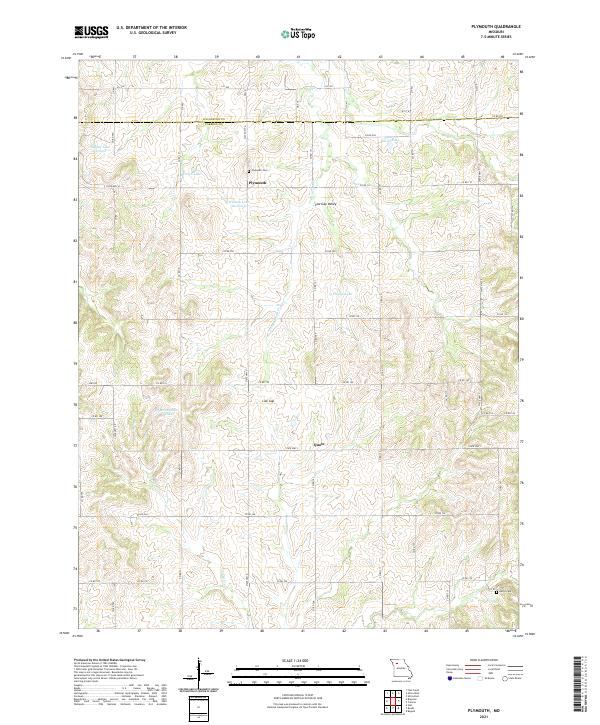
2021 Map of Plymouth
USGS Topo · Published 2021About this map
Plymouth and the small locality of Quote anchor this section of North Central Missouri, where the boundary between Livingston Co and Carroll Co divides a landscape defined by rolling drainages and agricultural land. The terrain is characterized by intricate water systems, including Turkey Cr and Cottonwood Cr, which feed into several named reservoirs such as McLaughlin Lake and Davies Lake.
Find a feature on this map
54 named features on this map. Tap any name to fly to it.
Don’t see what you’re looking for? This feature index may not catch every label — zoom into the map to look around manually.
Map Details
Editions of this 2021 Plymouth Map
This is the sole edition of this map. No revisions or reprints were ever made.
Other maps of this area

1889 · Lexington
USGS Topo · 1:125,000

1924 · Dawn
USGS Topo · 1:62,500

1924 · Braymer
USGS Topo · 1:62,500

1950 · Coloma
USGS Topo · 1:24,000

1950 · Plymouth
USGS Topo · 1:24,000

1951 · Utica
USGS Topo · 1:62,500

1953 · Moberly
USGS Topo · 1:250,000

1954 · Moberly
USGS Topo · 1:250,000

1957 · Moberly
USGS Topo · 1:250,000
1957 · Roads
USGS Topo · 1:24,000