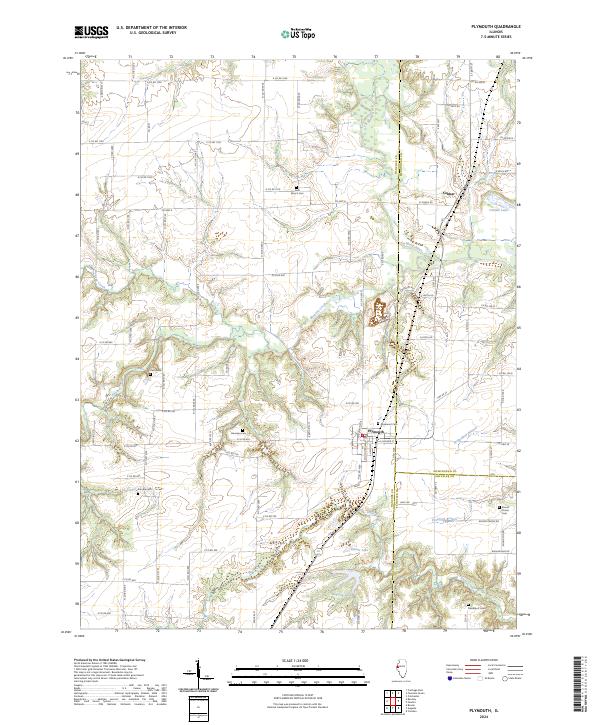
2024 Map of Plymouth
USGS Topo · Published 2024About this map
Plymouth sits at the junction of three Illinois counties, serving as a central point in a landscape defined by the winding La Moine River and its numerous tributaries. The map details a rural geography where early settlement patterns are visible through family and community landmarks like Saint Mary's Cem and Trimble Cem. The northern portion of the map is dominated by the small community of Colmar, located near the shores of Colmar Lake.
Find a feature on this map
77 named features on this map. Tap any name to fly to it.
Don’t see what you’re looking for? This feature index may not catch every label — zoom into the map to look around manually.
Map Details
Editions of this 2024 Plymouth Map
This is the sole edition of this map. No revisions or reprints were ever made.
Other maps of this area

1913 · Colchester
USGS Topo · 1:62,500

1933 · Carthage
USGS Topo · 1:62,500

1937 · Carthage
USGS Topo · 1:62,500

1946 · Augusta
USGS Topo · 1:62,500

1948 · Camp Point
USGS Topo · 1:62,500

1949 · Augusta
USGS Topo · 1:62,500

1958 · Burlington
USGS Topo · 1:250,000

1961 · Burlington
USGS Topo · 1:250,000

1963 · Burlington
USGS Topo · 1:250,000
1974 · Bentley
USGS Topo · 1:24,000