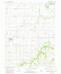
1957 Map of Plymouth
USGS Topo · Published 1980About this map
Plymouth serves as the primary hub of this eastern Nebraska landscape, situated near the intersection of the Chicago Rock Island and Pacific railroad and local rural roads. The area's agricultural and social foundations are evidenced by a network of local landmarks, including the Woodlawn Cem and the more isolated Kilpatrick Cem further east. The presence of rural education and community life is visible through School No 109 in the north and Trinity Sch near the boundary of Gage County.
Find a feature on this map
20 named features on this map. Tap any name to fly to it.
Don’t see what you’re looking for? This feature index may not catch every label — zoom into the map to look around manually.
Map Details
Editions of this 1957 Plymouth Map
2 editions found
Other maps of this area

1955 · Lincoln
USGS Topo · 1:250,000

1957 · Lincoln
USGS Topo · 1:250,000

1957 · Plymouth
USGS Topo · 1:24,000

1957 · Clatonia
USGS Topo · 1:24,000

1957 · Beatrice West
USGS Topo · 1:24,000

1957 · Wilber
USGS Topo · 1:24,000

1958 · Lincoln
USGS Topo · 1:250,000

1961 · Western SE
USGS Topo · 1:24,000
1961 · Swanton
USGS Topo · 1:24,000

1970 · Diller NE
USGS Topo · 1:24,000