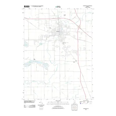
2010 Map of Plymouth
USGS Topo · Published 2010About this map
The Yellow River snakes through the heart of Plymouth in this 2010 topographic record, illustrating the settlement's deep connection to its waterways and historic transit corridors. The city is anchored by several established burial grounds, including Saint Michaels Cemetery, Oak Hill Cemetery, and the more outlying Tabor Cemetery. This modern era survey documents the convergence of historical routes like the Lincoln Hwy and Michigan Rd with contemporary infrastructure such as the Plymouth Municipal Airport and the Plymouth Speedway. To the southwest, the Twin Lakes area—comprising Holem Lake, Myers Lake, and Lawrence-Lake—presents a distinct cluster of residential development and recreation. The surrounding agricultural landscape is defined by an extensive drainage network, featuring named channels such as Schuh Ditch, Breeding DITCH, and Wolf Creek that support the region's rural economy.
Find a feature on this map
58 named features on this map. Tap any name to fly to it.
Don’t see what you’re looking for? This feature index may not catch every label — zoom into the map to look around manually.
Map Details
Editions of this 2010 Plymouth Map
This is the sole edition of this map. No revisions or reprints were ever made.
Other maps of this area

1953 · Chicago
USGS Topo · 1:250,000

1957 · Chicago
USGS Topo · 1:250,000

1957 · Inwood
USGS Topo · 1:24,000

1957 · Plymouth
USGS Topo · 1:24,000

1958 · Donaldson
USGS Topo · 1:24,000

1958 · Bremen
USGS Topo · 1:24,000

1958 · La Paz
USGS Topo · 1:24,000

1958 · Walkerton
USGS Topo · 1:24,000

1962 · Argos
USGS Topo · 1:24,000

1962 · Culver
USGS Topo · 1:24,000