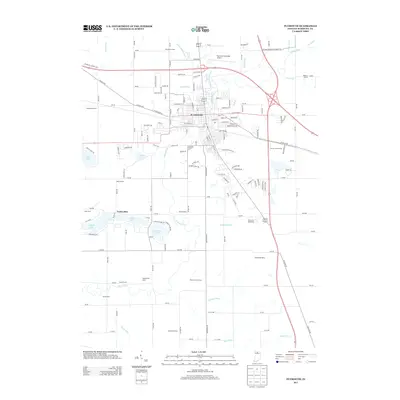
2013 Map of Plymouth
USGS Topo · Published 2013About this map
Plymouth serves as the focal point of this northern Indiana landscape, where the Yellow River meanders through a territory defined by a sophisticated network of drainage ditches and agricultural holdings. The map records a transition from the urban grid of the city to large named family operations such as Ganshorn Farms, Richards Dairy Farm, and Homestead Dairy. This agrarian pattern is deeply integrated with the natural hydrography, featuring a concentration of water bodies to the southwest, including Pretty Lake, Dixon Lake, and Twin Lakes. Infrastructure significant to the early 21st-century local economy is clearly visible, from the Plymouth Municipal Airport in the north to the Plymouth Speedway further south. Modern transportation corridors like the Lincoln Hwy and Plymouth Laporte Trl cut across the established township lines, illustrating the area's role as a regional crossroads.
Find a feature on this map
154 named features on this map. Tap any name to fly to it.
Don’t see what you’re looking for? This feature index may not catch every label — zoom into the map to look around manually.
Map Details
Editions of this 2013 Plymouth Map
This is the sole edition of this map. No revisions or reprints were ever made.
Other maps of this area

1953 · Chicago
USGS Topo · 1:250,000

1957 · Chicago
USGS Topo · 1:250,000

1957 · Inwood
USGS Topo · 1:24,000

1957 · Plymouth
USGS Topo · 1:24,000

1958 · Donaldson
USGS Topo · 1:24,000

1958 · Bremen
USGS Topo · 1:24,000

1958 · La Paz
USGS Topo · 1:24,000

1958 · Walkerton
USGS Topo · 1:24,000

1962 · Argos
USGS Topo · 1:24,000

1962 · Culver
USGS Topo · 1:24,000