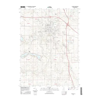
2016 Map of Plymouth
USGS Topo · Published 2016About this map
Plymouth serves as the focal point of this northern Indiana landscape, where the Yellow River winds through the heart of the community. The town's infrastructure is defined by a dense grid of residential streets and the historical path of the Pennsylvania RR. Surrounding the urban center, the terrain is shaped by an extensive network of drainage systems, including the Elmer Sellenright Ditch and Zimmer Ditch, which manage the low-lying agricultural lands. To the southwest, a distinctive cluster of glacial lakes—including Pretty Lake, Dixon Lake, and Lawrence Lake—provides a contrast to the geometric farmland. Genealogists will find value in the clearly marked locations of Saint Michaels Cem, Oak Hill Cem, and Tabor Cem, while the Plymouth Municipal Airport anchors the northern edge of the survey area.
Find a feature on this map
96 named features on this map. Tap any name to fly to it.
Don’t see what you’re looking for? This feature index may not catch every label — zoom into the map to look around manually.
Map Details
Editions of this 2016 Plymouth Map
This is the sole edition of this map. No revisions or reprints were ever made.
Other maps of this area

1953 · Chicago
USGS Topo · 1:250,000

1957 · Chicago
USGS Topo · 1:250,000

1957 · Inwood
USGS Topo · 1:24,000

1957 · Plymouth
USGS Topo · 1:24,000

1958 · Donaldson
USGS Topo · 1:24,000

1958 · Bremen
USGS Topo · 1:24,000

1958 · La Paz
USGS Topo · 1:24,000

1958 · Walkerton
USGS Topo · 1:24,000

1962 · Argos
USGS Topo · 1:24,000

1962 · Culver
USGS Topo · 1:24,000