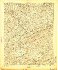
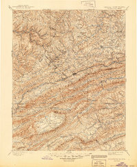
1895 Map of Pocahontas
USGS Topo · Published 1895About this map
Pocahontas serves as a focal point for this late nineteenth-century study of the Appalachian coal country along the border of Virginia and West Virginia. The landscape is defined by the heavy presence of the Norfolk and Western RR, which winds through narrow gaps and valleys to connect mining and industrial outposts like Bramwell, Mayberry, and Coaldale. The industrial footprint is evident at the Bluestone Quarry, while the surrounding terrain is a complex network of high ridges, including East River Mountain and Rich Mountain. These landforms dictate the settlement patterns, forcing towns like Bluefield and Graham into the corridor between the peaks. The map provides a look at the region before modern development, showing the proliferation of small settlements and church-centered communities such as Concord Church and Bethel that once anchored these hollows during the early industrial boom.
Find a feature on this map
130 named features on this map. Tap any name to fly to it.
Don’t see what you’re looking for? This feature index may not catch every label — zoom into the map to look around manually.
Map Details
Editions of this 1895 Pocahontas Map
6 editions found

Other maps of this area

1887 · Pocahontas
USGS Topo · 1:125,000

1887 · Hinton
USGS Topo · 1:125,000

1889 · Hillsville
USGS Topo · 1:125,000

1889 · Wytheville
USGS Topo · 1:125,000

1890 · Dublin
USGS Topo · 1:125,000

1891 · Tazewell
USGS Topo · 1:125,000

1891 · Pocahontas
USGS Topo · 1:125,000

1891 · Dublin
USGS Topo · 1:125,000

1891 · Oceana
USGS Topo · 1:125,000

1891 · Abingdon
USGS Topo · 1:125,000