Loading...
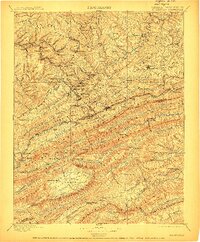
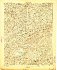
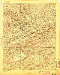
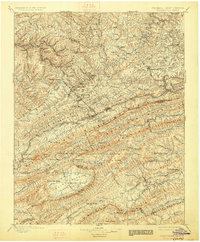
Loading map...1895 Map of Pocahontas
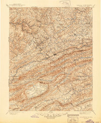
USGS Topo · Published 1912About this map
Pocahontas and the surrounding coalfields of the McDowell and Mercer County border regions stand at the center of this late 19th-century landscape. The Norfolk and Western RR snakes through narrow valleys, connecting a dense string of industrial settlements including Keystone, Vivian, and Elkhorn. This railway infrastructure was the lifeline for the region's extraction economy, following the corridor of Elkhorn Creek toward the West Virginia and Virginia line.
Find a feature on this map
160 named features on this map. Tap any name to fly to it.
Don’t see what you’re looking for? This feature index may not catch every label — zoom into the map to look around manually.
Map Details
Date Portrayed1895
Date Published1912
PublisherU.S. Geological Survey
Map TypeTopographic
Scale1:125,000
Physical Dimensions16.44 x 19.9 inches
Editions of this 1895 Pocahontas Map
6 editions found

Historical Maps of Bluefield Through Time
4 maps found


Featured Locations
Source Details
SourceU.S. Geological Survey
CopyrightPublic Domain