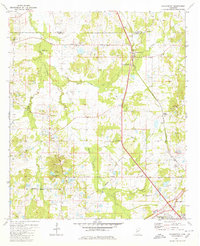
1980 Map of Pocahontas
USGS Topo · Published 1980About this map
Pocahontas Mounds and the adjacent Roadside Park anchor the northern landscape where Madison and Hinds counties meet. This 1980 survey reveals a countryside transitioning from rural agricultural roots toward modern suburban and recreational use, evidenced by the presence of the Live Oaks Country Club and the emerging residential area of Presidential Hills. The Natchez Trace Parkway cuts through the southeastern corner, paralleling the older transportation corridor of the Illinois Central Gulf railroad.
Find a feature on this map
47 named features on this map. Tap any name to fly to it.
Don’t see what you’re looking for? This feature index may not catch every label — zoom into the map to look around manually.
Map Details
Editions of this 1980 Pocahontas Map
3 editions found
Other maps of this area

1903 · Jackson
USGS Topo · 1:125,000

1905 · Jackson
USGS Topo · 1:48,000

1908 · Jackson
USGS Topo · 1:62,500

1934 · Raymond
USGS Topo · 1:48,000

1937 · Raymond
USGS Topo · 1:62,500

1942 · Raymond
USGS Topo · 1:62,500

1955 · Jackson
USGS Topo · 1:250,000

1961 · Jackson
USGS Topo · 1:250,000

1961 · Canton
USGS Topo · 1:62,500

1962 · Jackson
USGS Topo · 1:250,000