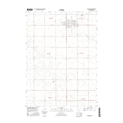
2015 Map of Pocahontas
USGS Topo · Published 2015About this map
Pocahontas serves as the focal point of this agricultural landscape in northwestern Iowa, where the rectilinear grid of township roads organizes the fertile terrain. The city is defined by a dense residential and commercial core, flanked by the Pocahontas Municipal Airport to the northeast and historical burial grounds including Calvary Cem and Summit Hill Cem. The surrounding sections are primarily open farmland, drained by the meandering Lizard Cr and its tributaries like S Br Lizard Cr. A legacy of industrial transport is visible in the naming of SE Railroad St, while further south, the Grant Township Cem stands as a quiet marker of early rural settlement. This survey also records the essential hydrological infrastructure of the region, specifically Drainage Ditch Number 66, which supports the productivity of this prairie landscape.
Find a feature on this map
52 named features on this map. Tap any name to fly to it.
Don’t see what you’re looking for? This feature index may not catch every label — zoom into the map to look around manually.
Map Details
Editions of this 2015 Pocahontas Map
This is the sole edition of this map. No revisions or reprints were ever made.
Other maps of this area

1954 · Fort Dodge
USGS Topo · 1:250,000

1957 · Fort Dodge
USGS Topo · 1:250,000

1958 · Fort Dodge
USGS Topo · 1:250,000

1971 · Laurens
USGS Topo · 1:24,000

1979 · Pocahontas
USGS Topo · 1:24,000

1979 · Fonda
USGS Topo · 1:24,000

1979 · Manson
USGS Topo · 1:24,000

1979 · Pomeroy
USGS Topo · 1:24,000

1979 · Palmer
USGS Topo · 1:24,000

1979 · Fonda NE
USGS Topo · 1:24,000