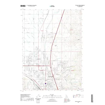
2020 Map of Pocatello North
USGS Topo · Published 2020About this map
Pocatello and Chubbuck dominate the landscape in this 2020 record of Bannock County, illustrating the dense urban corridor stretching north from the Portneuf River. The map captures the meeting of high-desert geography and complex irrigation engineering, where the Fort Hall Main Canal and numerous laterals like the Panther Lateral and Tyhee Lateral define the agricultural borders. The eastern portion of the quadrangle is defined by the elevation of the Pocatello Range and the Pocatello Bench, where the terrain transitions into features like Bluebird Ravine and Sage Hollow. This study reveals the modern footprint of Alameda and the settlement at Tyhee, providing a clear view of the transportation network along Yellowstone Ave and its relationship to the surrounding foothills and drainage systems like Little Pocatello Cr.
Find a feature on this map
235 named features on this map. Tap any name to fly to it.
Don’t see what you’re looking for? This feature index may not catch every label — zoom into the map to look around manually.
Map Details
Editions of this 2020 Pocatello North Map
This is the sole edition of this map. No revisions or reprints were ever made.
Other maps of this area

1934 · Michaud
USGS Topo · 1:62,500

1937 · Pocatello
USGS Topo · 1:48,000

1937 · Michaud
USGS Topo · 1:62,500

1940 · Blackfoot
USGS Topo · 1:62,500

1943 · Blackfoot
USGS Topo · 1:62,500

1944 · Pocatello
USGS Topo · 1:62,500

1954 · Pocatello
USGS Topo · 1:250,000

1955 · Pingree
USGS Topo · 1:24,000

1955 · Idaho Falls
USGS Topo · 1:250,000

1958 · Idaho Falls
USGS Topo · 1:250,000