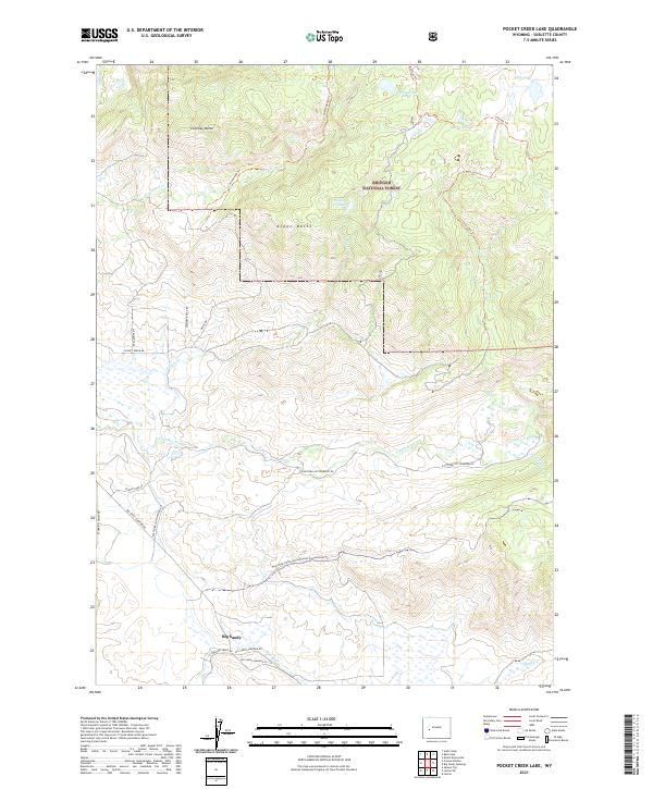
2021 Map of Pocket Creek Lake
USGS Topo · Published 2021About this map
Big Sandy sits at the southern edge of this high-elevation landscape, where the confluence of several creeks meets the E Fork River. The terrain is defined by prominent rises like Chimney Butte and Aspen Butte, which overlook a network of alpine waters including Pocket Cr Lake and Cottonwood Lake. This portion of the Bridger National Forest is heavily crisscrossed by recreation and utility routes, most notably the Wyoming Continental Divide Snowmobile Trl and the Lowline Trl. The drainage patterns of Cottonwood Cr and Jim Cr reveal a complex watershed that historically supported both seasonal ranching and wilderness access. Named forest roads such as Pocket Creek Rd and Eastfork Cottonwood Rd provide the primary framework for movement through this high country.
Find a feature on this map
32 named features on this map. Tap any name to fly to it.
Don’t see what you’re looking for? This feature index may not catch every label — zoom into the map to look around manually.
Map Details
Editions of this 2021 Pocket Creek Lake Map
This is the sole edition of this map. No revisions or reprints were ever made.
Other maps of this area

1938 · Mt Bonneville
USGS Topo · 1:62,500

1941 · Mt Bonneville
USGS Topo · 1:62,500

1942 · Mt Bonneville
USGS Topo · 1:62,500

1955 · Lander
USGS Topo · 1:250,000

1958 · Lander
USGS Topo · 1:250,000

1961 · Lander
USGS Topo · 1:250,000

1964 · Fremont Butte
USGS Topo · 1:24,000
1964 · Square Top
USGS Topo · 1:24,000
1968 · Scab Creek
USGS Topo · 1:24,000

1969 · Pocket Creek Lake
USGS Topo · 1:24,000