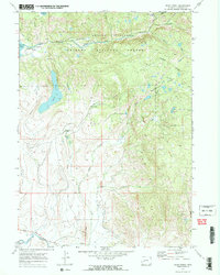
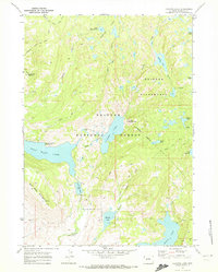
1968 Map of Scab Creek
USGS Topo · Published 1973About this map
Bridger National Forest and the high country of the Bridger Wilderness dominate this 1960s landscape, where glacial waters and ranching history converge. The map documents an intricate network of irrigation infrastructure essential to the high-plains economy, including the Taylor Ditch, Lovatt Ditch, and Jaycox No 1 Ditch. These man-made watercourses draw from the East Fork River and various creeks to support remote outposts like Boulder Lake Ranch and Mountain Springs Ranch.
Find a feature on this map
30 named features on this map. Tap any name to fly to it.
Don’t see what you’re looking for? This feature index may not catch every label — zoom into the map to look around manually.
Map Details
Editions of this 1968 Scab Creek Map
4 editions found
Other maps of this area

1938 · Mt Bonneville
USGS Topo · 1:62,500

1941 · Mt Bonneville
USGS Topo · 1:62,500

1942 · Mt Bonneville
USGS Topo · 1:62,500

1955 · Lander
USGS Topo · 1:250,000

1958 · Lander
USGS Topo · 1:250,000

1961 · Lander
USGS Topo · 1:250,000

1964 · Fremont Butte
USGS Topo · 1:24,000

1964 · Boulder Lake
USGS Topo · 1:24,000

1964 · Boulder
USGS Topo · 1:24,000
1968 · Fayette Lake
USGS Topo · 1:24,000