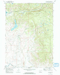
1968 Map of Scab Creek
USGS Topo · Published 1973About this map
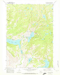
The high alpine landscape of Bridger Wilderness and Bridger National Forest dominates this 1968 field-checked survey. Dramatic water features define the topography, from the prominent Soda Lake and Boulder Lake in the west to the cascading North Fork Falls and Toboggan Creek in the east. The map records the intersection of wild land and cattle operations, marking Boulder Lake Ranch and Mountain Springs Ranch at the base of the foothills.
Find a feature on this map
35 named features on this map. Tap any name to fly to it.
Don’t see what you’re looking for? This feature index may not catch every label — zoom into the map to look around manually.
Map Details
Editions of this 1968 Scab Creek Map
4 editions found
Other maps of this area

1938 · Mt Bonneville
USGS Topo · 1:62,500

1941 · Mt Bonneville
USGS Topo · 1:62,500

1942 · Mt Bonneville
USGS Topo · 1:62,500

1955 · Lander
USGS Topo · 1:250,000

1958 · Lander
USGS Topo · 1:250,000

1961 · Lander
USGS Topo · 1:250,000

1964 · Fremont Butte
USGS Topo · 1:24,000

1964 · Boulder Lake
USGS Topo · 1:24,000

1964 · Boulder
USGS Topo · 1:24,000
1968 · Fayette Lake
USGS Topo · 1:24,000