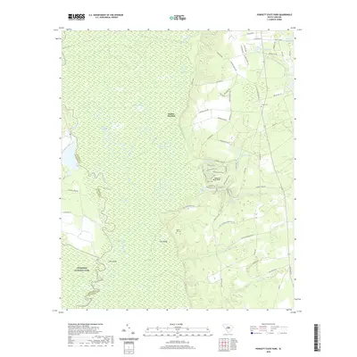
2020 Map of Poinsett State Park
USGS Topo · Published 2020About this map
Poinsett State Park and the eastern edge of Congaree National Park meet in this landscape defined by the convergence of river bottomlands and upland ridges. The Wateree River and its accompanying Wateree Swamp dominate the western portion of the area, creating a complex network of backwaters including Green Lake, Kohlers Old River, and Brushtop Lake. The terrain shifts dramatically at Sand Ridge, where the high ground east of the swamp hosted early transportation routes like Old Starks Ferry Rd. Historic land use is evident in the presence of Bloom Hill Cem and Coulter Cem, while the park interior features a developed trail system including the Cowasee Trail and Coquina Trail surrounding Poinsett Park Lake. The map records a transition from the wild floodplain of Joes Island to the managed recreational and timber lands near Sumter Junction.
Find a feature on this map
78 named features on this map. Tap any name to fly to it.
Don’t see what you’re looking for? This feature index may not catch every label — zoom into the map to look around manually.
Map Details
Editions of this 2020 Poinsett State Park Map
This is the sole edition of this map. No revisions or reprints were ever made.
Other maps of this area

1943 · Eastover
USGS Topo · 1:62,500

1946 · Elloree
USGS Topo · 1:62,500

1946 · Sumter
USGS Topo · 1:62,500

1953 · Poinsett State Park
USGS Topo · 1:24,000

1953 · Eastover
USGS Topo · 1:24,000

1953 · Wedgefield
USGS Topo · 1:24,000

1953 · Wateree
USGS Topo · 1:24,000

1954 · Augusta
USGS Topo · 1:250,000

1957 · Sumter West
USGS Topo · 1:24,000

1957 · Sumter
USGS Topo · 1:62,500