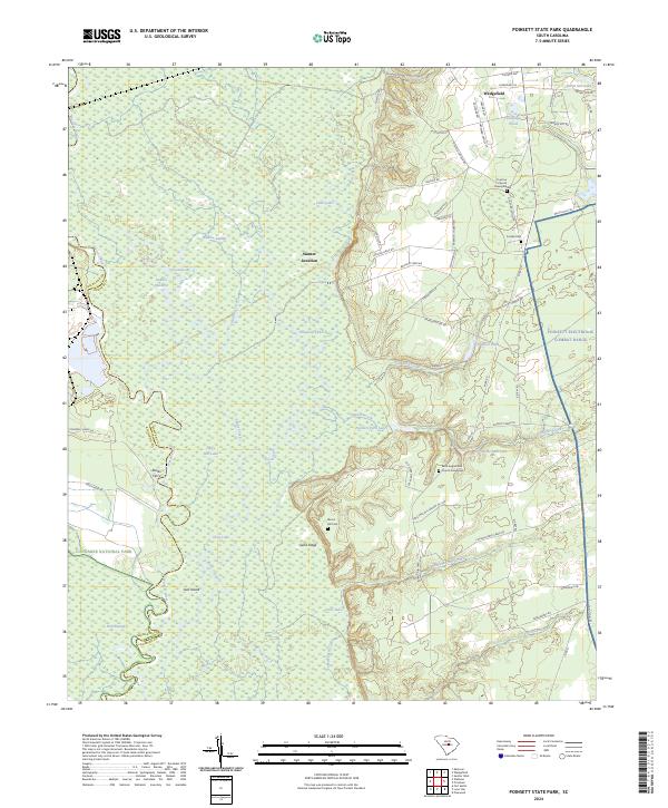
2024 Map of Poinsett State Park
USGS Topo · Published 2024About this map
Wateree Swamp and the meandering Wateree River define the western portion of this landscape, marking the boundary between Richland and Sumter counties. This low-lying riparian environment transitions into the upland forests of the High Hills of Santee, where the settlement of Wedgefield and the rail-linked Sumter Junction reside. The eastern half of the map reveals a complex land-use pattern, ranging from the protected wilderness of Congaree National Park to the modern military operations at the Poinsett Electronic Combat Range.
Find a feature on this map
73 named features on this map. Tap any name to fly to it.
Don’t see what you’re looking for? This feature index may not catch every label — zoom into the map to look around manually.
Map Details
Editions of this 2024 Poinsett State Park Map
This is the sole edition of this map. No revisions or reprints were ever made.
Other maps of this area

1943 · Eastover
USGS Topo · 1:62,500

1946 · Elloree
USGS Topo · 1:62,500

1946 · Sumter
USGS Topo · 1:62,500

1953 · Poinsett State Park
USGS Topo · 1:24,000

1953 · Eastover
USGS Topo · 1:24,000

1953 · Wedgefield
USGS Topo · 1:24,000

1953 · Wateree
USGS Topo · 1:24,000

1954 · Augusta
USGS Topo · 1:250,000

1957 · Sumter West
USGS Topo · 1:24,000

1957 · Sumter
USGS Topo · 1:62,500