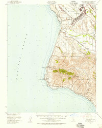
1947 Map of Point Arguello
USGS Topo · Published 1956About this map
Camp Cooke and the Lompoc Military Reservation dominate this coastal landscape, reflecting the heavy military presence in Santa Barbara County during and immediately following the war years. The map detail shows the extensive infrastructure of the camp, including the Barracks and proximity to the Santa Ynez River. Local history and heritage are represented by the location of Mission La Purisima in the northeast, while education in the rural interior is noted at the Artesia Sch.
Find a feature on this map
43 named features on this map. Tap any name to fly to it.
Don’t see what you’re looking for? This feature index may not catch every label — zoom into the map to look around manually.
Map Details
Editions of this 1947 Point Arguello Map
2 editions found
Other maps of this area

1905 · Guadalupe
USGS Topo · 1:125,000

1905 · Lompoc
USGS Topo · 1:125,000

1942 · Point Arguello
USGS Topo · 1:62,500

1942 · Guadalupe
USGS Topo · 1:125,000

1942 · Lompoc
USGS Topo · 1:125,000

1942 · Lompoc
USGS Topo · 1:62,500

1942 · Pt. Conception
USGS Topo · 1:62,500

1942 · Santa Maria
USGS Topo · 1:62,500

1942 · Point Sal
USGS Topo · 1:62,500

1943 · Lompoc
USGS Topo · 1:125,000