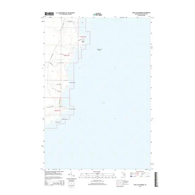
2014 Map of Point Aux Barques
USGS Topo · Published 2014About this map
Lake Michigan dominates the eastern half of this coastal survey, where the shoreline of Thompson Township is defined by a series of prominent geographical points. From north to south, Wiggins Point, Bourassas Point, Point aux Barques, Pillows Point, and Miller Point form a jagged edge against the water. The inland landscape is drained by numerous small watercourses, including Dead Horse Cr, Gierke Cr, and Bursaw Cr, which feed into the lake. Settlement is sparse, centered primarily around the intersection at Elmers Corner. A network of trails and roads such as Little Harbor Rd and Wiggins Point Trl provides access to the coastal bluffs and wooded interior, reflecting the rural and maritime character of this Upper Peninsula shoreline in the early 21st century.
Find a feature on this map
26 named features on this map. Tap any name to fly to it.
Don’t see what you’re looking for? This feature index may not catch every label — zoom into the map to look around manually.
Map Details
Editions of this 2014 Point Aux Barques Map
This is the sole edition of this map. No revisions or reprints were ever made.
Other maps of this area

1931 · Cooks NE
USGS Topo · 1:31,680

1931 · Cooks NW
USGS Topo · 1:31,680

1954 · Escanaba
USGS Topo · 1:250,000

1957 · Escanaba
USGS Topo · 1:250,000

1958 · Escanaba
USGS Topo · 1:250,000

1958 · Cooks
USGS Topo · 1:62,500
1972 · Manistique East
USGS Topo · 1:24,000

1983 · Manistique
USGS Topo · 1:100,000
1983 · Cooks
USGS Topo · 1:25,000
1983 · Manistique West
USGS Topo · 1:25,000