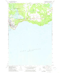
1972 Map of Manistique East
USGS Topo · Published 1975About this map
The city of Manistique serves as the focal point of this coastal survey, where the Manistique River meets the northern reaches of Lake Michigan. The landscape is defined by the complex hydrology of the river delta and its surrounding marshlands, including Goulds Slough, Island Slough, and Jamestown Slough. These waterways are protected within the Manistique River State Forest, illustrating the region's commitment to timber and wildlife conservation during the early 1970s.
Find a feature on this map
30 named features on this map. Tap any name to fly to it.
Don’t see what you’re looking for? This feature index may not catch every label — zoom into the map to look around manually.
Map Details
Editions of this 1972 Manistique East Map
This is the sole edition of this map. No revisions or reprints were ever made.
Other maps of this area

1931 · Cooks NE
USGS Topo · 1:31,680

1931 · Steuben SE
USGS Topo · 1:31,680

1931 · Manistique River SE
USGS Topo · 1:31,680

1931 · Manistique River SW
USGS Topo · 1:31,680

1954 · Escanaba
USGS Topo · 1:250,000

1957 · Escanaba
USGS Topo · 1:250,000

1958 · Escanaba
USGS Topo · 1:250,000

1958 · Cooks
USGS Topo · 1:62,500
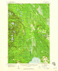
1958 · Steuben
USGS Topo · 1:62,500

1958 · Marquette
USGS Topo · 1:250,000