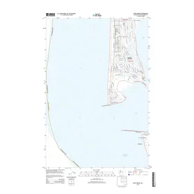
2014 Map of Point Brown
USGS Topo · Published 2014About this map
Ocean Shores occupies the narrow peninsula at the entrance to Grays Harbor, a coastal landscape defined by its intricate residential canal system and proximity to the Pacific Ocean. This survey reveals the structured expansion of the community, where streets such as Point Brown Ave SE and Lakeview Loop NE frame the freshwater Duck Lake. The transition from the sandy coast to the sheltered waters of North Bay is marked by the presence of the Municipal Airport and the Ocean Shores Golf Course, highlighting the area's development as a maritime recreation hub.
Find a feature on this map
83 named features on this map. Tap any name to fly to it.
Don’t see what you’re looking for? This feature index may not catch every label — zoom into the map to look around manually.
Map Details
Editions of this 2014 Point Brown Map
This is the sole edition of this map. No revisions or reprints were ever made.
Other maps of this area

1938 · Moclips
USGS Topo · 1:62,500

1941 · Moclips
USGS Topo · 1:62,500

1941 · Grayland
USGS Topo · 1:62,500

1943 · Copalis Beach
USGS Topo · 1:250,000

1951 · Copalis Beach
USGS Topo · 1:250,000

1955 · Point Brown
USGS Topo · 1:24,000

1955 · Copalis Beach
USGS Topo · 1:24,000

1956 · Copalis Crossing
USGS Topo · 1:24,000
1956 · Westport
USGS Topo · 1:24,000
1956 · Grayland
USGS Topo · 1:24,000