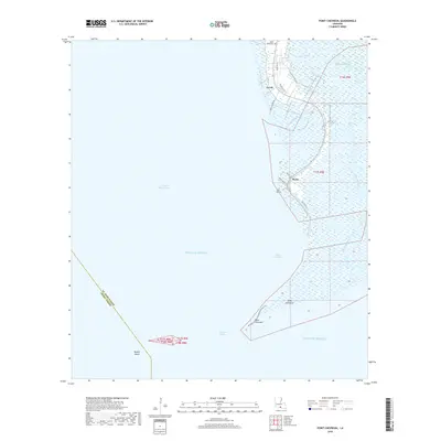
2018 Map of Point Chevreuil
USGS Topo · Published 2018About this map
Burns and Gordy sit along the southeastern edge of this coastal survey, where the Louisiana marsh meets the Gulf of Mexico. The landscape is dominated by an intricate network of wetlands and waterways, including Leopard Bayou, Oyster Bayou, and Horseshoe Bayou. Significant coastal features such as Salt Point, Tucky Hammock, and Point Chevreuil define the interface between the mainland and the open waters of Bayou Sale Bay. Further out in the East Cote Blanche Bay, Rabbit Island stands near the boundary between St. Mary Parish and Iberia Parish. The map reveals the infrastructure of the local petroleum industry, with specialized access routes like Mobil Oil Ln, United Gas Ln, and Marathon Ln cutting through the marshland to reach remote extraction sites and landings.
Find a feature on this map
28 named features on this map. Tap any name to fly to it.
Don’t see what you’re looking for? This feature index may not catch every label — zoom into the map to look around manually.
Map Details
Editions of this 2018 Point Chevreuil Map
This is the sole edition of this map. No revisions or reprints were ever made.
Other maps of this area

1935 · Belle Isle
USGS Topo · 1:31,680

1937 · Bayou Sale
USGS Topo · 1:62,500

1941 · Belle Isle
USGS Topo · 1:62,500

1945 · New Orleans
USGS Topo · 1:250,000
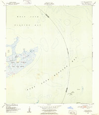
1951 · Lake Point
USGS Topo · 1:24,000

1954 · Belle Isle
USGS Topo · 1:62,500

1957 · Bayou Sale
USGS Topo · 1:62,500

1957 · Point Au Fer
USGS Topo · 1:62,500

1963 · New Orleans
USGS Topo · 1:250,000

1966 · New Orleans
USGS Topo · 1:250,000