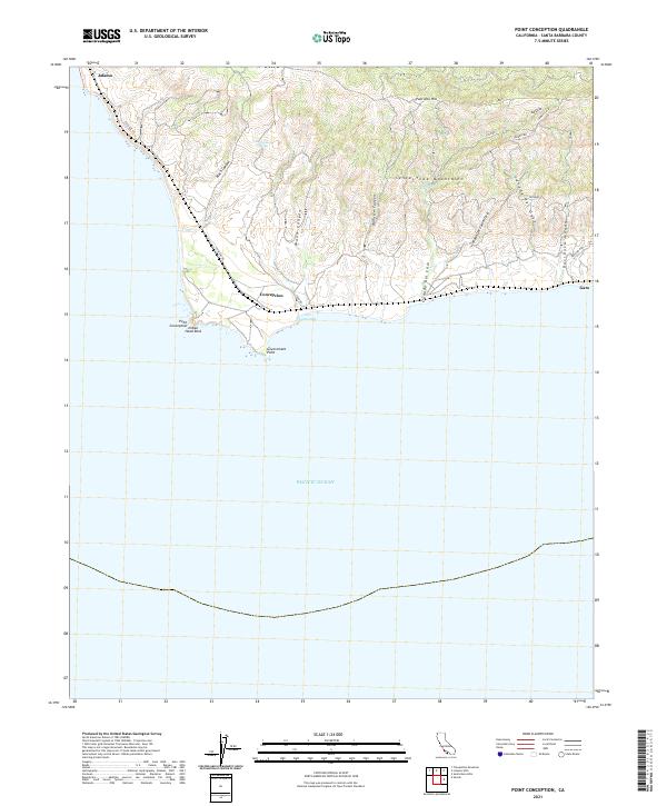
2021 Map of Point Conception
USGS Topo · Published 2021About this map
Point Conception serves as a critical geographic pivot point on the California coast, where the shoreline turns sharply eastward into the Santa Barbara Channel. This 2021 survey details the meeting of the Santa Ynez Mountains and the sea, dominated by coastal canyons such as Cañada Del Cojo and Cañada del Gato. The sparse settlement pattern at Concepcion and Jalama reflects the region's enduring character as a restricted-access landscape, largely comprised of private ranch lands and maritime navigational aids. Landmarks like Indian Head Rock and Government Point define the immediate coast, while the sheltered waters of Cojo Anchorage provide a rare point of refuge along this exposed stretch of the Pacific. The presence of local place names like Cañada Del Cementerio and roads like Rancho Real hint at the area's deep history of cattle ranching and early California land grants.
Find a feature on this map
38 named features on this map. Tap any name to fly to it.
Don’t see what you’re looking for? This feature index may not catch every label — zoom into the map to look around manually.
Map Details
Editions of this 2021 Point Conception Map
This is the sole edition of this map. No revisions or reprints were ever made.
Other maps of this area

1905 · Guadalupe
USGS Topo · 1:125,000

1905 · Lompoc
USGS Topo · 1:125,000

1942 · Point Arguello
USGS Topo · 1:62,500

1942 · Guadalupe
USGS Topo · 1:125,000

1942 · Lompoc
USGS Topo · 1:125,000

1942 · Lompoc
USGS Topo · 1:62,500

1942 · Pt. Conception
USGS Topo · 1:62,500

1943 · Lompoc
USGS Topo · 1:125,000
1947 · Santa Rosa Hills
USGS Topo · 1:24,000
1947 · El Tranquillon
USGS Topo · 1:24,000