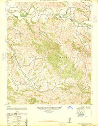
1947 Map of Santa Rosa Hills
USGS Topo · Published 1947About this map
The Santa Ynez River carves through the northern reaches of this coastal range, defining a landscape of deep canyons and rugged ridges just after the second World War. This territory, largely defined by large landholdings like Rancho El Jaro and the expansive San Julian area, reflects the enduring ranching heritage of the Central Coast. Local life at mid-century centers on small social anchors, including the San Julian School and Rinconada Church, situated along the winding paths of El Jaro Creek and Salsipuedes Creek.
Find a feature on this map
18 named features on this map. Tap any name to fly to it.
Don’t see what you’re looking for? This feature index may not catch every label — zoom into the map to look around manually.
Map Details
Editions of this 1947 Santa Rosa Hills Map
2 editions found
Other maps of this area

1905 · Lompoc
USGS Topo · 1:125,000

1942 · Lompoc
USGS Topo · 1:125,000

1942 · Lompoc
USGS Topo · 1:62,500

1942 · Pt. Conception
USGS Topo · 1:62,500

1942 · Gaviota
USGS Topo · 1:62,500

1942 · Los Olivos
USGS Topo · 1:62,500

1943 · Los Olivos
USGS Topo · 1:62,500

1943 · Lompoc
USGS Topo · 1:125,000

1943 · Gaviota
USGS Topo · 1:62,500

1947 · Lompoc
USGS Topo · 1:24,000