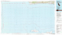
1981 Map of Point Conception
USGS Topo · Published 1981About this map
The Santa Ynez Mountains descend to the Pacific coastline where the iconic Point Conception headland marks the transition between Central and Southern California. This 1981 survey documents the rugged coastal geography of Santa Barbara County, including the prominent lighthouse and the coastal path of the Southern Pacific railroad. Small settlements like Gaviota, Concepcion, and Tajiguas dot the narrow shoreline beneath the mountains, while much of the upland is protected within the Los Padres National Forest.
Find a feature on this map
42 named features on this map. Tap any name to fly to it.
Don’t see what you’re looking for? This feature index may not catch every label — zoom into the map to look around manually.
Map Details
Editions of this 1981 Point Conception Map
This is the sole edition of this map. No revisions or reprints were ever made.
Other maps of this area

1902 · Santa Ynez
USGS Topo · 1:125,000

1905 · Guadalupe
USGS Topo · 1:125,000

1905 · Santa Ynez
USGS Topo · 1:125,000

1905 · Lompoc
USGS Topo · 1:125,000

1941 · San Rafael Mtn.
USGS Topo · 1:62,500

1942 · Point Arguello
USGS Topo · 1:62,500

1942 · Guadalupe
USGS Topo · 1:125,000

1942 · Lompoc
USGS Topo · 1:125,000

1942 · Lompoc
USGS Topo · 1:62,500

1942 · Pt. Conception
USGS Topo · 1:62,500