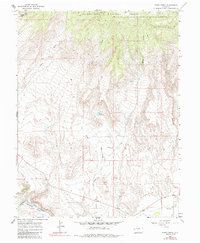
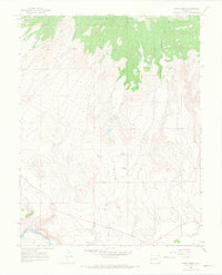
1965 Map of Point Creek
USGS Topo · Published 1985About this map
The Grand Mesa landscape dominates this mid-1960s survey, where the high elevations of the Grand Mesa National Forest descend into the river valleys of Delta County. The southern edge of the map follows the winding course of the Gunnison River, shadowed by the tracks of the Denver and Rio Grande Western railroad. This corridor served as a vital artery for transport through the western slope, connecting the agricultural interests and ranching outposts found throughout the canyon lands.
Find a feature on this map
13 named features on this map. Tap any name to fly to it.
Don’t see what you’re looking for? This feature index may not catch every label — zoom into the map to look around manually.
Map Details
Editions of this 1965 Point Creek Map
3 editions found
Other maps of this area

1956 · Moab
USGS Topo · 1:250,000

1959 · Moab
USGS Topo · 1:250,000

1960 · Moab
USGS Topo · 1:250,000

1962 · Moab
USGS Topo · 1:250,000
1962 · North Delta
USGS Topo · 1:24,000
1962 · Delta
USGS Topo · 1:24,000

1964 · Moab
USGS Topo · 1:250,000

1965 · Moab
USGS Topo · 1:250,000
1965 · Point Creek
USGS Topo · 1:24,000
1965 · Hells Kitchen
USGS Topo · 1:24,000