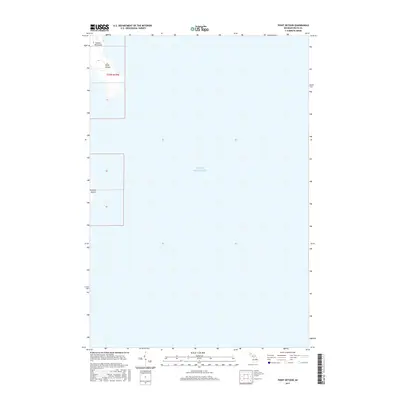
2017 Map of Point Detour
USGS Topo · Published 2017About this map
Garden Peninsula and the northern tip of Summer Island mark the southern reach of Delta County where the land gives way to the open waters of Lake Michigan. This coastal environment is defined by the sharp limestone features of the Niagara Escarpment, represented here by the prominence of Point Detour. The map illustrates the sparsely populated, maritime character of this region during the early 21st century, where the landscape is dominated by dense forest and dramatic rocky shorelines rather than inland development. The limited landmass shown is organized under the Public Land Survey System within Township 37 North, Range 19 West, highlighting the remote and rugged nature of this portion of Michigan's Upper Peninsula.
Find a feature on this map
5 named features on this map. Tap any name to fly to it.
Don’t see what you’re looking for? This feature index may not catch every label — zoom into the map to look around manually.
Map Details
Editions of this 2017 Point Detour Map
This is the sole edition of this map. No revisions or reprints were ever made.
Other maps of this area

1932 · Burnt Bluff SW
USGS Topo · 1:31,680

1932 · Burnt Bluff NE
USGS Topo · 1:31,680

1932 · Burnt Bluff NW
USGS Topo · 1:31,680

1954 · Escanaba
USGS Topo · 1:250,000

1957 · Escanaba
USGS Topo · 1:250,000

1958 · Escanaba
USGS Topo · 1:250,000

1958 · Fairport
USGS Topo · 1:62,500

1983 · Manistique
USGS Topo · 1:100,000

1984 · Washington Island
USGS Topo · 1:100,000
1985 · Devils Corner
USGS Topo · 1:24,000