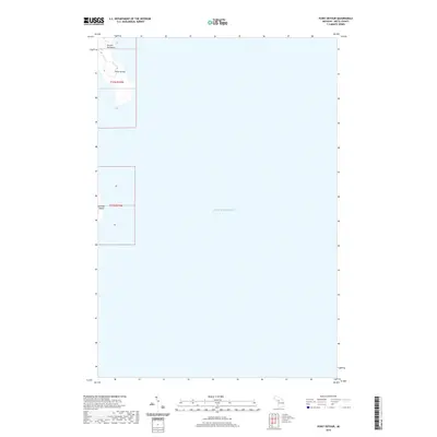
2019 Map of Point Detour
USGS Topo · Published 2019About this map
The southern tip of the Garden Peninsula and the nearby Summer Island mark the transition between Big Bay de Noc and the open waters of Lake Michigan. This 2019 survey captures the maritime landscape of Fairbanks Township, where Point Detour projects into the lake. The map reveals the intricate shoreline of the peninsula's extremity, highlighting the relationship between these remote landmasses and the surrounding Great Lake. While mostly characterized by open water, the sheet provides precise topographic and hydrographic details for these essential coastal points, making it a valuable resource for understanding the contemporary geography of this northern Michigan archipelago.
Find a feature on this map
10 named features on this map. Tap any name to fly to it.
Don’t see what you’re looking for? This feature index may not catch every label — zoom into the map to look around manually.
Map Details
Editions of this 2019 Point Detour Map
This is the sole edition of this map. No revisions or reprints were ever made.
Other maps of this area

1932 · Burnt Bluff SW
USGS Topo · 1:31,680

1932 · Burnt Bluff NE
USGS Topo · 1:31,680

1932 · Burnt Bluff NW
USGS Topo · 1:31,680

1954 · Escanaba
USGS Topo · 1:250,000

1957 · Escanaba
USGS Topo · 1:250,000

1958 · Escanaba
USGS Topo · 1:250,000

1958 · Fairport
USGS Topo · 1:62,500

1983 · Manistique
USGS Topo · 1:100,000

1984 · Washington Island
USGS Topo · 1:100,000
1985 · Devils Corner
USGS Topo · 1:24,000