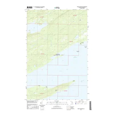
2017 Map of Point Houghton
USGS Topo · Published 2017About this map
Isle Royale National Park dominates this remote archipelago landscape, where the southern reaches of the island meet the cold waters of Lake Superior. The topography is defined by parallel ridges like Houghton Ridge, which separate the interior lakes and wetlands from the rugged shoreline. Extensive water bodies such as Lake Desor and Mud Lake drain through the Little Siskiwit River toward the protected waters of Siskiwit Bay. Small, tucked-away coastal features like Little Boat Harbor and Fishermans Home Cove hint at the island's maritime history and the seasonal shelters used by those navigating the Houghton Point Passage. From Checker Point to Butterfield Point, the map details a complex interface of rocky points and shoals that have long challenged Lake Superior mariners.
Find a feature on this map
27 named features on this map. Tap any name to fly to it.
Don’t see what you’re looking for? This feature index may not catch every label — zoom into the map to look around manually.
Map Details
Editions of this 2017 Point Houghton Map
This is the sole edition of this map. No revisions or reprints were ever made.
Other maps of this area

1958 · Hancock
USGS Topo · 1:250,000

1959 · Fort William
USGS Topo · 1:250,000

1960 · Hancock
USGS Topo · 1:250,000

1961 · Hancock
USGS Topo · 1:250,000

1966 · Hancock
USGS Topo · 1:250,000

1968 · Fort William
USGS Topo · 1:250,000

1985 · Todd Harbor
USGS Topo · 1:100,000

1985 · Pigeon Point
USGS Topo · 1:100,000

1985 · Siskiwit Bay
USGS Topo · 1:100,000

1985 · Grand Portage
USGS Topo · 1:100,000