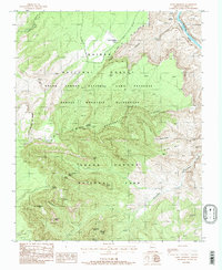
1988 Map of Point Imperial
USGS Topo · Published 1988About this map
Colorado River waters flow through Marble Canyon at the northeastern corner of this landscape, marking a stark boundary beside the Navajo Indian Reservation. The terrain is defined by dramatic elevation changes across the Grand Canyon National Park and the Kaibab National Forest, where high overlooks like Point Imperial provide views over a complex system of buttes and canyons. The Saddle Mountain Wilderness occupies the central portion of the sheet, characterized by a network of trails including the Pack Trail that traverses the high ridges. Named landmarks such as Mount Hayden, Sullivan Peak, and Hancock Butte highlight the verticality of the region, while the Saddle Canyon Tank and Kolb Arch offer specific points of interest for those tracing the geological and human navigation of this protected wilderness in the late twentieth century.
Find a feature on this map
36 named features on this map. Tap any name to fly to it.
Don’t see what you’re looking for? This feature index may not catch every label — zoom into the map to look around manually.
Map Details
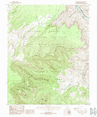
Editions of this 1988 Point Imperial Map
2 editions found
Other maps of this area

1886 · Echo Cliffs
USGS Topo · 1:250,000

1886 · Kaibab
USGS Topo · 1:250,000

1891 · Echo Cliffs
USGS Topo · 1:250,000

1903 · Bright Angel
USGS Topo · 1:48,000

1906 · Bright Angel
USGS Topo · 1:48,000

1907 · Vishnu
USGS Topo · 1:48,000

1953 · Grand Canyon
USGS Topo · 1:250,000

1954 · Nankoweap
USGS Topo · 1:62,500

1956 · Marble Canyon
USGS Topo · 1:250,000

1957 · Grand Canyon
USGS Topo · 1:250,000