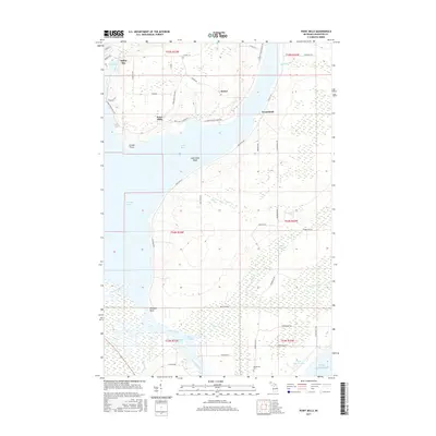
2017 Map of Point Mills
USGS Topo · Published 2017About this map
Point Mills and the industrial coastline of Torch Bay define this landscape on the Keweenaw Peninsula. The map details the transition from the sheltered waters of Portage Lake to the open expanse of Lake Superior, capturing the area as it appeared in the mid-2010s. Settlement patterns are concentrated along the shoreline, featuring the community of Dollar Bay in the northwest and the small outpost of Senter further east.
Find a feature on this map
58 named features on this map. Tap any name to fly to it.
Don’t see what you’re looking for? This feature index may not catch every label — zoom into the map to look around manually.
Map Details
Editions of this 2017 Point Mills Map
This is the sole edition of this map. No revisions or reprints were ever made.
Other maps of this area

1915 · Houghton
USGS Topo · 1:62,500

1946 · Hancock
USGS Topo · 1:24,000

1946 · Chassell
USGS Topo · 1:24,000

1946 · Laurium
USGS Topo · 1:24,000

1948 · Laurium
USGS Topo · 1:24,000

1948 · Hancock
USGS Topo · 1:24,000

1948 · Chassell
USGS Topo · 1:24,000

1954 · Traverse Island
USGS Topo · 1:24,000
1954 · Rice Lake
USGS Topo · 1:24,000

1954 · Keweenaw Bay
USGS Topo · 1:62,500