
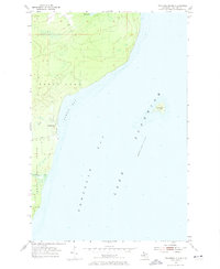
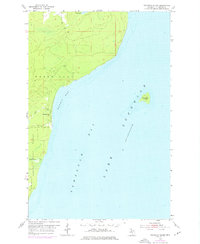
1954 Map of Traverse Island
USGS Topo · Published 1955About this map
Traverse Island sits prominently in the waters of Lake Superior off the eastern coast of the Keweenaw Peninsula, serving as the central landmark for this coastal survey. The shoreline is defined by the sweeping curve of Rabbit Bay, where the small settlement of Rabbit Bay is tucked along the coast near the mouth of Lahti Creek. Further south, the landscape is heavily wooded, encompassing a portion of the Baraga State Forest and the winding course of Le Chance Cr. The inland terrain transitions from low-lying wetlands around Mud Lake to the edges of Torch Lake in the northwest. This map illustrates the intersection of the region's timber resources and its maritime environment, showing the varied bathymetry of Keweenaw Bay alongside the unimproved coastal roads and isolated settlements of mid-century Houghton County.
Find a feature on this map
13 named features on this map. Tap any name to fly to it.
Don’t see what you’re looking for? This feature index may not catch every label — zoom into the map to look around manually.
Map Details
Editions of this 1954 Traverse Island Map
3 editions found
Other maps of this area

1938 · Gay
USGS Topo · 1:31,680

1946 · Laurium
USGS Topo · 1:24,000

1948 · Laurium
USGS Topo · 1:24,000
1954 · Gay
USGS Topo · 1:24,000
1954 · Rice Lake
USGS Topo · 1:24,000

1954 · Skanee
USGS Topo · 1:62,500

1954 · Keweenaw Bay
USGS Topo · 1:62,500

1954 · Point Mills
USGS Topo · 1:24,000

1958 · Hancock
USGS Topo · 1:250,000

1958 · Iron River
USGS Topo · 1:250,000