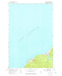
1954 Map of Beacon Hill
USGS Topo · Published 1976About this map
Lake Superior defines the northern edge of this coastal survey, where the industrial legacy of Michigan's Copper Country is etched into the landscape of Stanton township. The map documents the critical infrastructure of the era, including the Redridge Dam and a prominent stack near the shoreline, signaling the intensive milling operations that once thrived here. Small company towns like Freda and Beacon Hill are shown in detail, connected by the remnants of the transportation network such as the Railroad Grade. These settlements, perched on the bluffs above the lake, were central to the processing of copper ore. Farther inland, the Salmon Trout River flows toward the coast, passing near Redridge and a Boy Scout Camp, illustrating a mix of heavy industry and the emerging recreational use of the Keweenaw Peninsula's shoreline during the mid-20th century.
Find a feature on this map
10 named features on this map. Tap any name to fly to it.
Don’t see what you’re looking for? This feature index may not catch every label — zoom into the map to look around manually.
Map Details
Editions of this 1954 Beacon Hill Map
Other maps of this area

1915 · Houghton
USGS Topo · 1:62,500

1946 · South Range
USGS Topo · 1:24,000

1948 · South Range
USGS Topo · 1:24,000

1954 · Graveraet River
USGS Topo · 1:24,000

1954 · Oskar
USGS Topo · 1:24,000

1954 · Beacon Hill
USGS Topo · 1:24,000

1954 · Rockhouse Point
USGS Topo · 1:24,000

1954 · Houghton
USGS Topo · 1:62,500

1958 · Hancock
USGS Topo · 1:250,000

1960 · Hancock
USGS Topo · 1:250,000