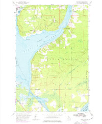
1954 Map of Point Mills
USGS Topo · Published 1976About this map
The industrial and maritime landscape of the Keweenaw Peninsula is captured here, centered on the waters of Torch Lake and Portage Lake Bay. Along the northern shores, the community of Dollar Bay and the specialized settlement of Senter are visible, the latter featuring a prominent Water Tank and an Old Railroad Grade that reflects the region's historical reliance on rail for mineral transport. Near Point Mills, a legacy of the copper mining era is evident in the presence of a Mine Dump overlooking the water.
Find a feature on this map
35 named features on this map. Tap any name to fly to it.
Don’t see what you’re looking for? This feature index may not catch every label — zoom into the map to look around manually.
Map Details
Editions of this 1954 Point Mills Map
3 editions found

Other maps of this area

1915 · Houghton
USGS Topo · 1:62,500

1946 · Hancock
USGS Topo · 1:24,000

1946 · Chassell
USGS Topo · 1:24,000

1946 · Laurium
USGS Topo · 1:24,000

1948 · Laurium
USGS Topo · 1:24,000

1948 · Hancock
USGS Topo · 1:24,000

1948 · Chassell
USGS Topo · 1:24,000

1954 · Traverse Island
USGS Topo · 1:24,000
1954 · Rice Lake
USGS Topo · 1:24,000

1954 · Keweenaw Bay
USGS Topo · 1:62,500