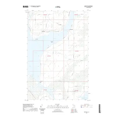
2019 Map of Point Mills
USGS Topo · Published 2019About this map
The settlement of Point Mills and the nearby industrial hamlet of Senter occupy a narrow neck of land between Dollar Bay and Torch Bay. This landscape is defined by its relationship with the water, where the Portage Lake waterway connects toward Lake Superior through the Portage River. Along the eastern shore, the village of Jacobsville sits near the historic Jacobsville Cem, overlooking a coastline shaped by the region's quarrying and maritime history.
Find a feature on this map
56 named features on this map. Tap any name to fly to it.
Don’t see what you’re looking for? This feature index may not catch every label — zoom into the map to look around manually.
Map Details
Editions of this 2019 Point Mills Map
This is the sole edition of this map. No revisions or reprints were ever made.
Other maps of this area

1915 · Houghton
USGS Topo · 1:62,500

1946 · Hancock
USGS Topo · 1:24,000

1946 · Chassell
USGS Topo · 1:24,000

1946 · Laurium
USGS Topo · 1:24,000

1948 · Laurium
USGS Topo · 1:24,000

1948 · Hancock
USGS Topo · 1:24,000

1948 · Chassell
USGS Topo · 1:24,000

1954 · Traverse Island
USGS Topo · 1:24,000
1954 · Rice Lake
USGS Topo · 1:24,000

1954 · Keweenaw Bay
USGS Topo · 1:62,500