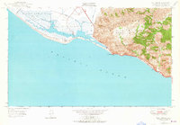
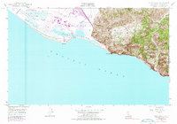
1949 Map of Point Mugu
USGS Topo · Published 1964About this map
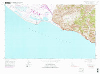
Point Mugu Naval Reservation dominates the coastal wetlands where Calleguas Creek meets the tidal waters of Mugu Lagoon. This 1949 survey illustrates the strategic coastal geography of Ventura County, showing the proximity of naval operations to the diverse terrain of the Santa Monica Mountains. To the west, the alluvial plains of the Rio De Santa Clara are marked by Duck Ponds and a complex drainage system, while the eastern portion of the map rises sharply into peaks like Laguna Pk and Mugu Pk. The winding Roosevelt Highway traces the coastline beneath these steep ridges, providing the primary transportation link between the isolated La Jolla Valley and the broader coastal plain. Deep drainages such as Big Sycamore Canyon and Serrano Canyon cut through the mountains, highlighting the challenging topography that defined early development in this section of the California coast.
Find a feature on this map
18 named features on this map. Tap any name to fly to it.
Don’t see what you’re looking for? This feature index may not catch every label — zoom into the map to look around manually.
Map Details
Editions of this 1949 Point Mugu Map
6 editions found
Other maps of this area

1900 · Triunfo Pass
USGS Topo · 1:62,500

1903 · Camulos
USGS Topo · 1:125,000

1904 · Hueneme
USGS Topo · 1:62,500

1921 · Triunfo Pass
USGS Topo · 1:62,500

1932 · Arroyo Sequit
USGS Topo · 1:24,000

1942 · Hueneme
USGS Topo · 1:62,500

1943 · Hueneme
USGS Topo · 1:62,500
1943 · Triunfo Pass
USGS Topo · 1:62,500

1949 · Los Angeles
USGS Topo · 1:250,000

1949 · Oxnard
USGS Topo · 1:24,000