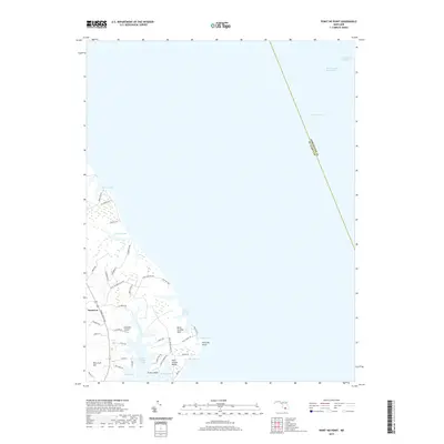
2019 Map of Point No Point
USGS Topo · Published 2019About this map
Saint Jerome Creek and its many winding tributaries dominate this coastal landscape on the western shore of the Chesapeake Bay. The map documents a maritime-focused geography where the land is fragmented into distinct necks and points, including Saint Jerome Neck and the notable landmark Point No Point. Inland, the settlement of Dameron sits along Three Notch Rd, while the coastal community at Saint Jerome Beach provides access to Malone Bay. The presence of Wingfield Airport near Diamond Ln highlights the region's modern infrastructure amidst traditional water-bound features like Biscoe Pond and Carroll Pond. Navigational markers such as the Chesapeake Channel and the Intracoastal Waterway underscore the area's continued importance for Mid-Atlantic shipping and recreation.
Find a feature on this map
47 named features on this map. Tap any name to fly to it.
Don’t see what you’re looking for? This feature index may not catch every label — zoom into the map to look around manually.
Map Details
Editions of this 2019 Point No Point Map
This is the sole edition of this map. No revisions or reprints were ever made.
Other maps of this area

1892 · Drum Point
USGS Topo · 1:62,500

1894 · Point Lookout
USGS Topo · 1:62,500

1898 · St. Marys
USGS Topo · 1:125,000

1901 · Drum Point
USGS Topo · 1:62,500

1903 · Bloodsworth Island
USGS Topo · 1:62,500

1905 · Crapo
USGS Topo · 1:62,500

1905 · Drum Point
USGS Topo · 1:62,500

1906 · St. Marys
USGS Topo · 1:125,000

1912 · Point Lookout
USGS Topo · 1:62,500

1937 · Point Lookout
USGS Topo · 1:62,500