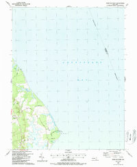
1987 Map of Point No Point
USGS Topo · Published 1987About this map
The tapering peninsula of St Jerome Neck defines this coastal landscape on the western shore of the Chesapeake Bay. The terrain is characterized by intricate inlets and small coastal bodies of water, including Biscoe Pond, Carroll Pond, and Filbert Pond. Inland, the settlement of Dameron sits near the head of St Jerome Creek, which snakes southward toward the bay.
Find a feature on this map
25 named features on this map. Tap any name to fly to it.
Don’t see what you’re looking for? This feature index may not catch every label — zoom into the map to look around manually.
Map Details
Editions of this 1987 Point No Point Map
This is the sole edition of this map. No revisions or reprints were ever made.
Other maps of this area

1892 · Drum Point
USGS Topo · 1:62,500

1894 · Point Lookout
USGS Topo · 1:62,500

1898 · St. Marys
USGS Topo · 1:125,000

1901 · Drum Point
USGS Topo · 1:62,500

1903 · Bloodsworth Island
USGS Topo · 1:62,500

1905 · Crapo
USGS Topo · 1:62,500

1905 · Drum Point
USGS Topo · 1:62,500

1906 · St. Marys
USGS Topo · 1:125,000

1912 · Point Lookout
USGS Topo · 1:62,500

1937 · Point Lookout
USGS Topo · 1:62,500