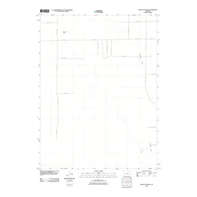
2010 Map of Point of Rocks
USGS Topo · Published 2010About this map
Point of Rocks names both a distinctive terrain feature and a settlement location in this section of Weld County, Colorado. The landscape is defined by the ephemeral passage of Sanborn Draw, which meanders through the eastern half of the quadrangle. The map captures a strictly organized rural grid system, dominated by a network of numbered county roads that facilitate movement across the open plains.
Find a feature on this map
16 named features on this map. Tap any name to fly to it.
Don’t see what you’re looking for? This feature index may not catch every label — zoom into the map to look around manually.
Map Details
Editions of this 2010 Point of Rocks Map
This is the sole edition of this map. No revisions or reprints were ever made.
Other maps of this area

1950 · Greasewood Lake
USGS Topo · 1:24,000

1950 · Barnesville
USGS Topo · 1:24,000

1950 · Masters
USGS Topo · 1:24,000

1950 · Hardin
USGS Topo · 1:24,000

1951 · Masters
USGS Topo · 1:24,000

1951 · Hardin
USGS Topo · 1:24,000

1951 · Point Of Rocks
USGS Topo · 1:24,000
1951 · Dearfield
USGS Topo · 1:24,000

1954 · Greeley
USGS Topo · 1:250,000

1957 · Greeley
USGS Topo · 1:250,000