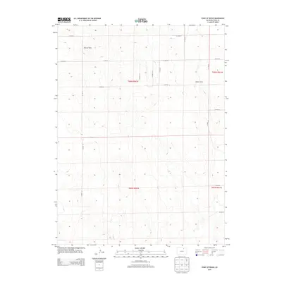
2013 Map of Point of Rocks
USGS Topo · Published 2013About this map
Point of Rocks rises as a prominent landmark in this section of Weld County, defining a landscape marked by wide open spaces and a structured grid of rural infrastructure. This 2013 survey by the U.S. Geological Survey captures the area's transition into the 21st century, where the natural drainage of Sanborn Draw intersects with an extensive network of county routes. The map shows the systematic organization of the land into townships like t006n r062w and t005n r062w, a pattern typical of the High Plains where ranching and agricultural access are facilitated by roads such as Co Road 70 and Co Road 85. The sparse settlement pattern emphasized here suggests a region dedicated to large-scale land use, with few named points of interest outside the essential transportation corridors and topographical markers.
Find a feature on this map
19 named features on this map. Tap any name to fly to it.
Don’t see what you’re looking for? This feature index may not catch every label — zoom into the map to look around manually.
Map Details
Editions of this 2013 Point of Rocks Map
This is the sole edition of this map. No revisions or reprints were ever made.
Other maps of this area

1950 · Greasewood Lake
USGS Topo · 1:24,000

1950 · Barnesville
USGS Topo · 1:24,000

1950 · Masters
USGS Topo · 1:24,000

1950 · Hardin
USGS Topo · 1:24,000

1951 · Masters
USGS Topo · 1:24,000

1951 · Hardin
USGS Topo · 1:24,000

1951 · Point Of Rocks
USGS Topo · 1:24,000
1951 · Dearfield
USGS Topo · 1:24,000

1954 · Greeley
USGS Topo · 1:250,000

1957 · Greeley
USGS Topo · 1:250,000