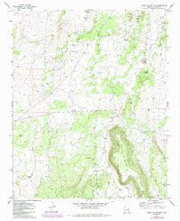
1971 Map of Point of the Mtn
USGS Topo · Published 1984About this map
Hay Hollow Draw and its various tributaries define this arid landscape in eastern Arizona, where water management is the primary marker of human activity. This 1971 survey illustrates a region largely dedicated to ranching, characterized by a series of named water tanks and infrastructure scattered across the high plateau. The presence of Winter Camp and Barbara Well suggests the functional nature of the area's settlement, likely serving as seasonal outposts or operational hubs for local livestock operations.
Find a feature on this map
19 named features on this map. Tap any name to fly to it.
Don’t see what you’re looking for? This feature index may not catch every label — zoom into the map to look around manually.
Map Details
Editions of this 1971 Point of the Mtn Map
2 editions found
Other maps of this area

1886 · St Johns
USGS Topo · 1:250,000

1886 · Holbrook
USGS Topo · 1:250,000

1892 · St Johns
USGS Topo · 1:250,000

1893 · Holbrook
USGS Topo · 1:250,000

1954 · Holbrook
USGS Topo · 1:250,000

1954 · Saint Johns
USGS Topo · 1:250,000

1955 · Adamana 3 NE
USGS Topo · 1:24,000

1955 · Adamana 3 SE
USGS Topo · 1:24,000

1957 · Holbrook
USGS Topo · 1:250,000

1957 · Saint Johns
USGS Topo · 1:250,000