Loading...
Loading map...1952 Map of Point Roberts
USGS Topo · Published 1973About this map
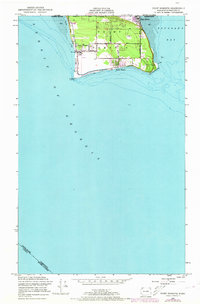
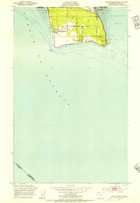
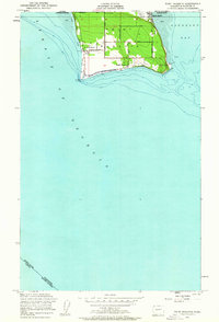
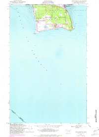
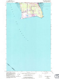
Point Roberts occupies a unique geographic position at the 49th parallel, shown here as an American enclave separated by the international border from the rest of Washington. This 1952 survey, updated with 1972 revisions, details the isolated peninsula where Roosevelt Road runs along the boundary line with Canada. The settlement of Maple Beach sits at the northeastern corner against the Canadian border, while the Pt Roberts Lighthouse marks the southwestern tip facing the Strait of Georgia.
Find a feature on this map
27 named features on this map. Tap any name to fly to it.
Don’t see what you’re looking for? This feature index may not catch every label — zoom into the map to look around manually.
Map Details
Date Portrayed1952
Date Published1973
PublisherU.S. Geological Survey
Map TypeTopographic
Scale1:24,000
Physical Dimensions18 x 27.3 inches
Editions of this 1952 Point Roberts Map
5 editions found
Historical Maps of Point Roberts Through Time
3 maps found

Featured Locations
Source Details
SourceU.S. Geological Survey
CopyrightPublic Domain