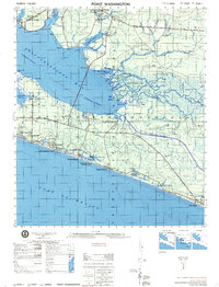
1974 Map of Point Washington
USGS Topo · Published 1974About this map
Choctawhatchee Bay and the Emerald Coast shoreline dominate this 1974 survey, capturing Walton County during a period of transition and coastal development. The Intracoastal Waterway cuts across the landscape, connecting West Bayou to the larger bay system, while the northern reaches include a portion of Eglin Air Force Base and the Pt Washington Base A installation. Inland, the map documents established local anchors such as Black Creek Church and the Santa Rosa Cemetery.
Find a feature on this map
94 named features on this map. Tap any name to fly to it.
Don’t see what you’re looking for? This feature index may not catch every label — zoom into the map to look around manually.
Map Details
Editions of this 1974 Point Washington Map
This is the sole edition of this map. No revisions or reprints were ever made.
Other maps of this area

1934 · Niceville
USGS Topo · 1:48,000

1935 · Villa Tasso
USGS Topo · 1:48,000

1935 · De Funiak Springs
USGS Topo · 1:48,000

1936 · Niceville
USGS Topo · 1:62,500

1936 · Point Washington
USGS Topo · 1:48,000

1938 · Villa Tasso
USGS Topo · 1:62,500

1938 · De Funiak Springs
USGS Topo · 1:62,500

1939 · Point Washington
USGS Topo · 1:62,500

1943 · Laguna Beach
USGS Topo · 1:31,680

1943 · Seminole Hills
USGS Topo · 1:24,000