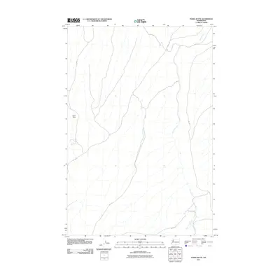
2011 Map of Poisel Butte
USGS Topo · Published 2011About this map
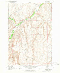
Poisel Butte rises above the arid drainage patterns of central Washington in this 2011 survey of the Yakama Indian Reservation. The landscape is defined by the ephemeral flow of Mule Dry Creek and Mule Creek, illustrating the seasonal water reliance of this high-plateau region. A network of Bureau of Indian Affairs roads, including BIA 31 Rd and BIA 43 Rd, crisscross the terrain to connect remote outposts and geographic landmarks. Notable for local history and land-use studies is Sampson Cabin in the southeast, a rare named structure in a territory characterized primarily by its natural features and vital water sources like Poisel Butte Spring. The map documents a sparsely settled area where transportation and habitation remain closely tied to the few permanent water features found in the hills.
Find a feature on this map
13 named features on this map. Tap any name to fly to it.
Don’t see what you’re looking for? This feature index may not catch every label — zoom into the map to look around manually.
Map Details
Editions of this 2011 Poisel Butte Map
This is the sole edition of this map. No revisions or reprints were ever made.
Other maps of this area

1910 · Zillah
USGS Topo · 1:125,000

1950 · Yakima
USGS Topo · 1:250,000

1958 · Hembre Mtn
USGS Topo · 1:24,000

1958 · Toppenish SW
USGS Topo · 1:24,000

1958 · Yakima
USGS Topo · 1:250,000

1961 · Yakima
USGS Topo · 1:250,000
1965 · Bluelight
USGS Topo · 1:24,000
1965 · Bluelight NW
USGS Topo · 1:24,000
1965 · Granger
USGS Topo · 1:62,500
1965 · Poisel Butte NW
USGS Topo · 1:24,000