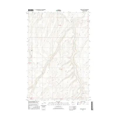
2017 Map of Poisel Butte
USGS Topo · Published 2017About this map
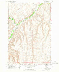
Poisel Butte rises as a prominent landmark in this section of Yakima County, defining the local topography and drainage patterns. The landscape is characterized by intermittent water features like Mule Dry Cr and the essential Poisel Butte Spring, which sit among a network of Bureau of Indian Affairs (BIA) routes. This 2017 survey shows a land shaped by the Public Land Survey System, with grid lines crossing through townships t8n r20e and t9n r20e. The road network, including names like Yakima Chief Rd and Sohappy Rd, suggests a landscape used for rangeland or resource management rather than dense residential development. Genealogists and historians can use these specific BIA road designations and family-named routes like Mule Rd to locate specific land tracts and historic access points in this corner of Washington.
Find a feature on this map
18 named features on this map. Tap any name to fly to it.
Don’t see what you’re looking for? This feature index may not catch every label — zoom into the map to look around manually.
Map Details
Editions of this 2017 Poisel Butte Map
This is the sole edition of this map. No revisions or reprints were ever made.
Other maps of this area

1910 · Zillah
USGS Topo · 1:125,000

1950 · Yakima
USGS Topo · 1:250,000

1958 · Hembre Mtn
USGS Topo · 1:24,000

1958 · Toppenish SW
USGS Topo · 1:24,000

1958 · Yakima
USGS Topo · 1:250,000

1961 · Yakima
USGS Topo · 1:250,000
1965 · Bluelight
USGS Topo · 1:24,000
1965 · Bluelight NW
USGS Topo · 1:24,000
1965 · Granger
USGS Topo · 1:62,500
1965 · Poisel Butte NW
USGS Topo · 1:24,000