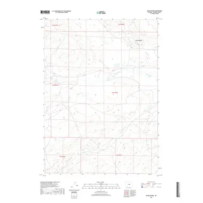
2018 Map of Poison Spider
USGS Topo · Published 2018About this map
Poison Spider and its surrounding drainage systems define this section of Natrona County, where the high plains terrain is etched by seasonal watercourses and local infrastructure. The landscape is dominated by the winding paths of Poison Spider Cr, Austin Cr, and the dual-labeled Meadow Creek. Human presence is marked by a network of rural routes including Co Rd 201 and Co Rd 210, which facilitate movement through the township and range grids of the Public Land Survey System. A specific nod to the region's industrial ties is found in the northern portion of the map along Oil Camp Rd, suggesting the historical and ongoing significance of energy extraction in this remote Wyoming corridor. The map effectively documents the intersection of natural hydrology and the utilitarian road network used to navigate the open range.
Find a feature on this map
14 named features on this map. Tap any name to fly to it.
Don’t see what you’re looking for? This feature index may not catch every label — zoom into the map to look around manually.
Map Details
Editions of this 2018 Poison Spider Map
This is the sole edition of this map. No revisions or reprints were ever made.
Other maps of this area

1951 · Pine Mountain SW
USGS Topo · 1:24,000

1951 · Oil Mountain
USGS Topo · 1:24,000

1951 · Clarkson Hill
USGS Topo · 1:24,000

1951 · Emigrant Gap NW
USGS Topo · 1:24,000

1951 · Poison Spider
USGS Topo · 1:24,000

1951 · Benton Basin NE
USGS Topo · 1:24,000

1951 · Mc Cleary Reservoir
USGS Topo · 1:24,000

1951 · Square Top Butte
USGS Topo · 1:24,000

1951 · Reid Canyon
USGS Topo · 1:24,000

1955 · Casper
USGS Topo · 1:250,000