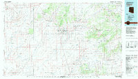
1982 Map of Polacca
USGS Topo · Published 1983About this map
The ancient mesas of northeastern Arizona define this landscape, where high plateaus are separated by the seasonal drainage systems of Dinnebito Wash and Oraibi Wash. This survey captures the traditional settlement patterns of the Hopi and Navajo people, with historic villages situated atop First Mesa, Second Mesa, and Third Mesa. Renowned cultural centers such as Old Oraibi and Walpi are documented alongside newer developments like Keams Canyon and Polacca. The topography is dominated by dramatic relief, ranging from the Moenkopi Plateau to the south toward the volcanic landmarks of the Hopi Buttes. Vital water sources for these high-desert communities are carefully noted, including Sunlight Spring and the Sunlight Mission, illustrating the essential connection between reliable springs and the establishment of permanent settlements in this arid environment.
Find a feature on this map
98 named features on this map. Tap any name to fly to it.
Don’t see what you’re looking for? This feature index may not catch every label — zoom into the map to look around manually.
Map Details
Editions of this 1982 Polacca Map
2 editions found
Other maps of this area

1883 · Marsh Pass
USGS Topo · 1:250,000

1883 · Tusayan
USGS Topo · 1:250,000

1886 · Tusayan
USGS Topo · 1:250,000

1886 · Fort Defiance
USGS Topo · 1:250,000

1886 · San Francisco Mtns
USGS Topo · 1:250,000

1886 · Echo Cliffs
USGS Topo · 1:250,000

1891 · San Francisco Mtns
USGS Topo · 1:250,000

1891 · Echo Cliffs
USGS Topo · 1:250,000

1892 · Fort Defiance
USGS Topo · 1:250,000

1892 · Marsh Pass
USGS Topo · 1:250,000