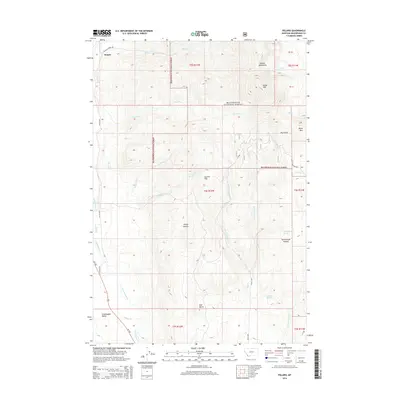
2014 Map of Polaris
USGS Topo · Published 2014About this map
Polaris serves as the primary settlement hub in this high-elevation landscape within the Beaverhead National Forest. The terrain is defined by the Pioneer Mountains, where peaks like Baldy Mtn and Black Mtn overlook a complex drainage system including Billings Creek, Farlin Creek, and the southern Grasshopper Creek. Notable water sources such as Old Faithful Spring and Lockridge Spring are identified near the Yellowstone Plateau and the Grasshopper Valley, suggesting the area's vital hydrological importance. This survey illustrates a wilderness-oriented economy where access is maintained through routes like MT-278 and Billings Creek Road. The map provides clear demarcations of the rugged topography, from the depths of Sheep Canyon and Dry Gulch to the prominence of Garrett Hill and Red Butte.
Find a feature on this map
37 named features on this map. Tap any name to fly to it.
Don’t see what you’re looking for? This feature index may not catch every label — zoom into the map to look around manually.
Map Details
Editions of this 2014 Polaris Map
This is the sole edition of this map. No revisions or reprints were ever made.
Other maps of this area

1893 · Dillon
USGS Topo · 1:250,000

1952 · Bannack
USGS Topo · 1:24,000

1952 · Torrey Mountain
USGS Topo · 1:24,000

1952 · Ermont
USGS Topo · 1:24,000

1955 · Dillon
USGS Topo · 1:250,000

1957 · Dillon
USGS Topo · 1:250,000

1958 · Dillon
USGS Topo · 1:250,000

1959 · Polaris
USGS Topo · 1:62,500

1959 · Grant
USGS Topo · 1:62,500

1962 · Dillon
USGS Topo · 1:250,000